| Choose
a subset: |
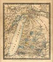 |
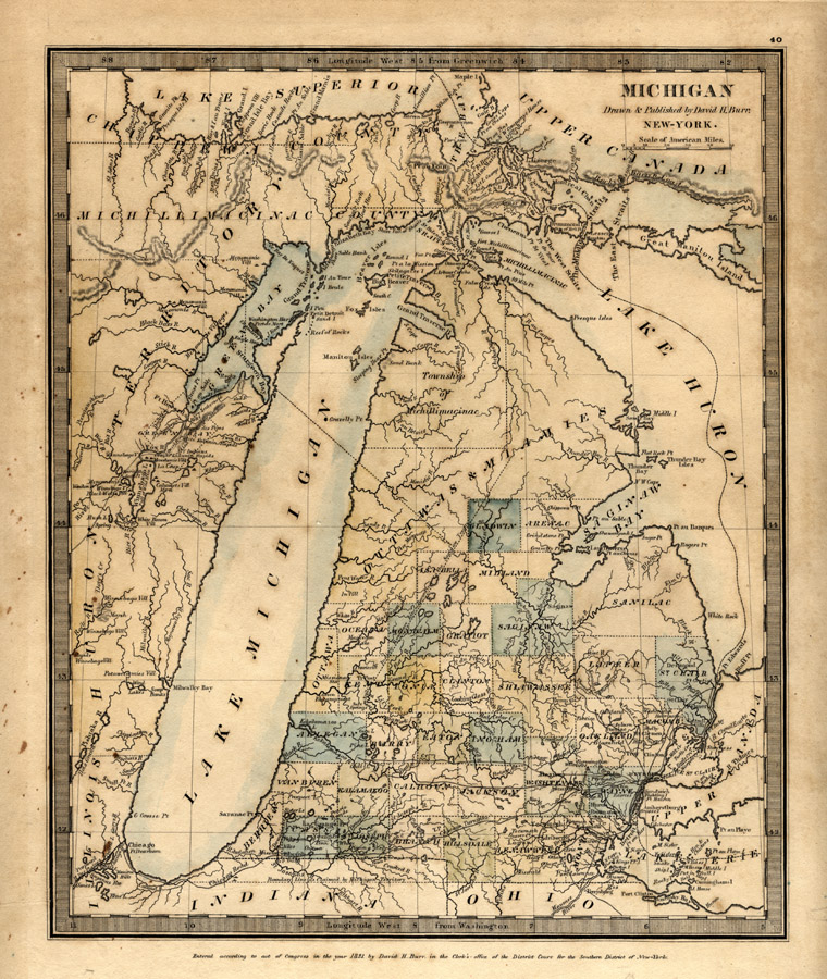
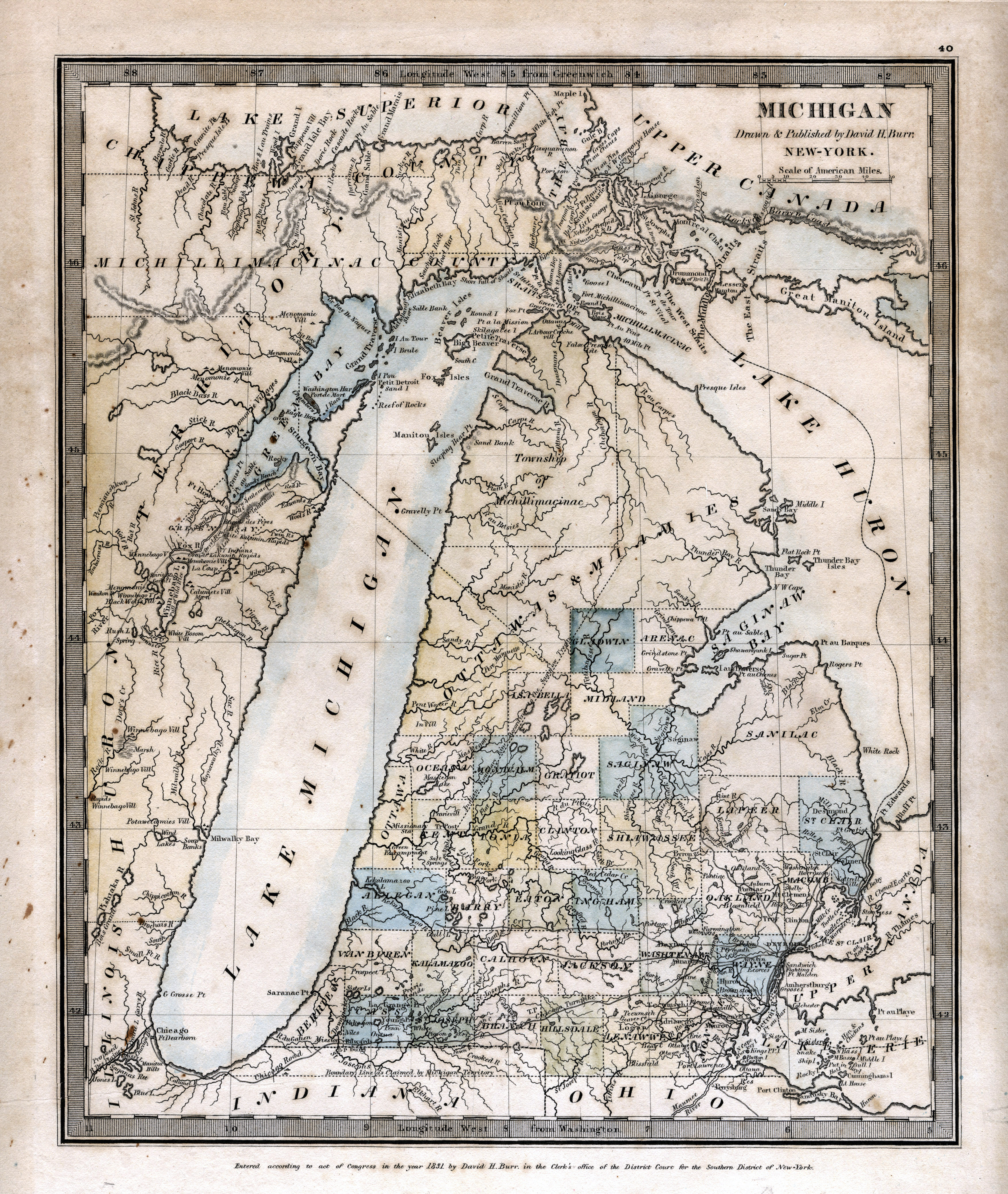
"Michigan" (1831) from Michigan/drawn & published by David H. Burr. New York: D. H. Burr. 1831.
|
|||
 |
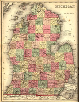
"A New Map of Michigan with its Canals, Roads &
Distances" (1853) Published by Thomas, Cowperthwait & Co. No.
253
Market Street, Philadelphia. 1853. [843
D-1853 Michigan]
|
|||
 |
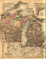
"Map of the States of Michigan and Wisconsin" (1858) in Mitchell's school atlas : comprising the maps and tables designed to accompany Mitchell's school and family geography. Philadelphia: E.H.Butler and Co.,1866, c1865. [folio G1019 .M67 1867]
|
|||
 |
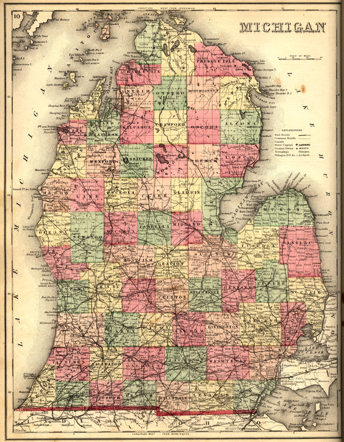
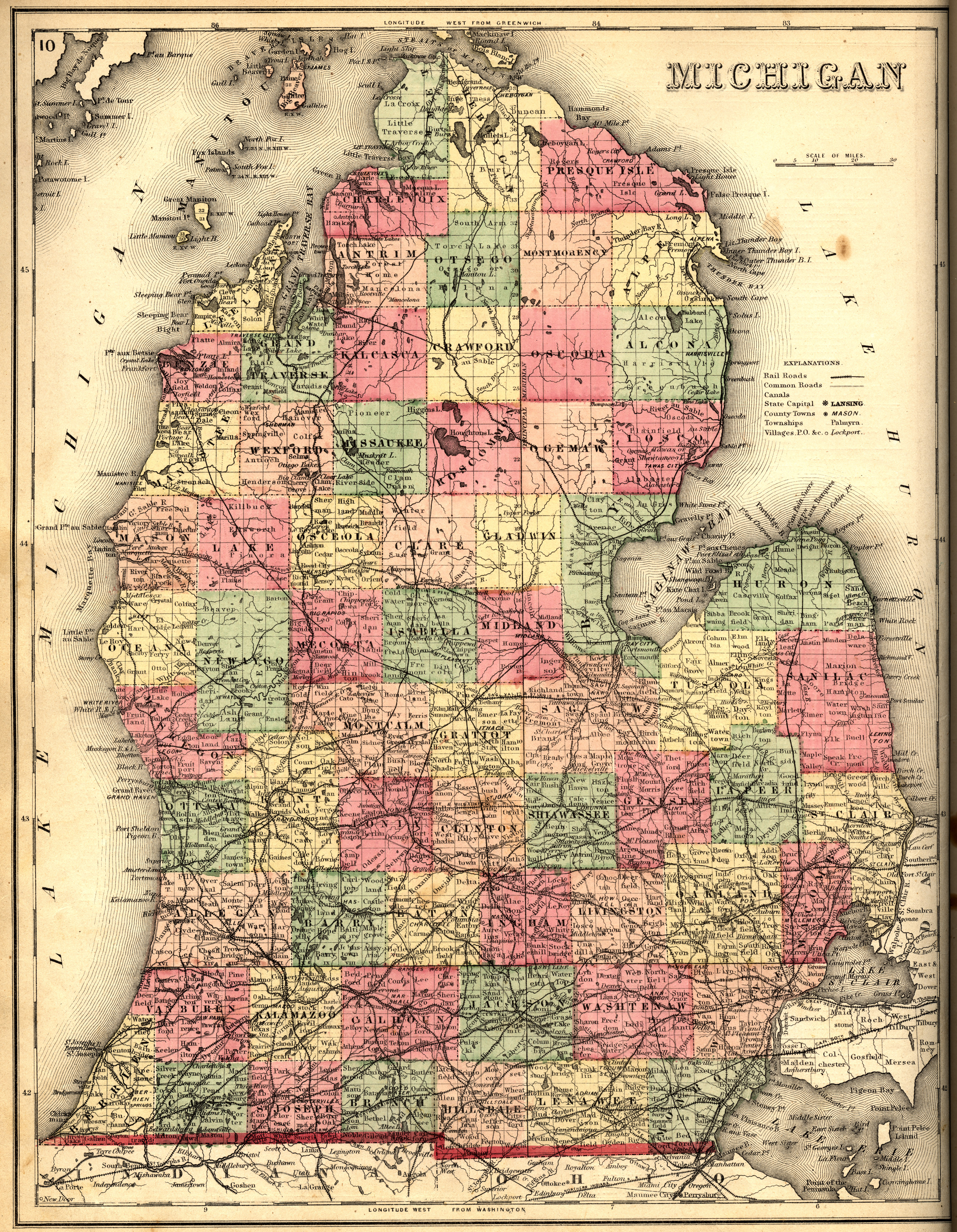
"Michigan (Lower Peninsula)" (1873) in Atlas of Calhoun Co. Michigan : from recent and actual surveys and records / under the superintendence of F.W. Beers. New York : F.W. Beers. 1873. [g1413.C2 B4 1873]
|
|||
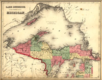 |
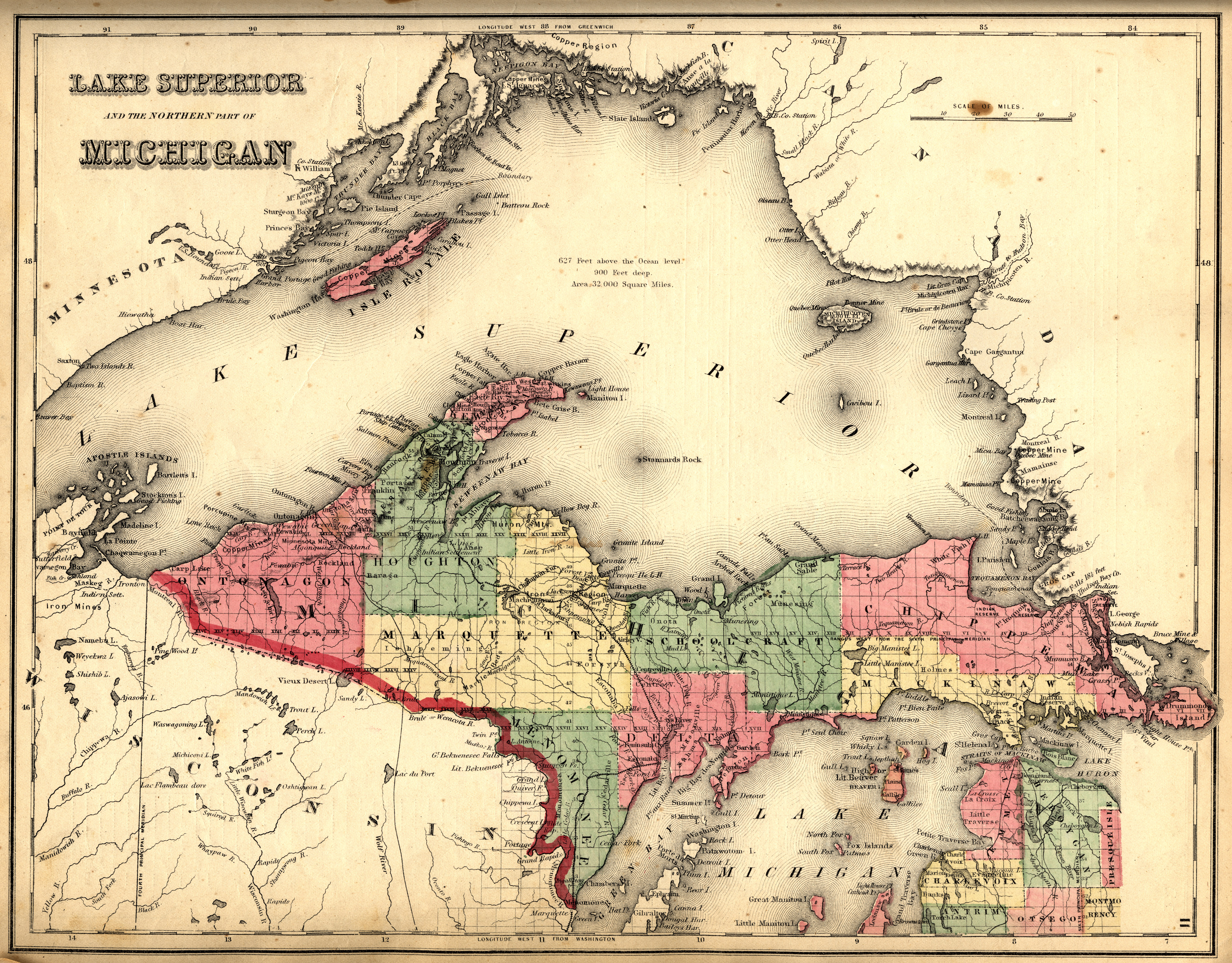
"Michigan (Upper Peninsula)" (1873) in Atlas of Calhoun Co. Michigan : from recent and actual surveys and records / under the superintendence of F.W. Beers. New York : F.W. Beers. 1873. [g1413.C2 B4 1873]
|
|||
 |
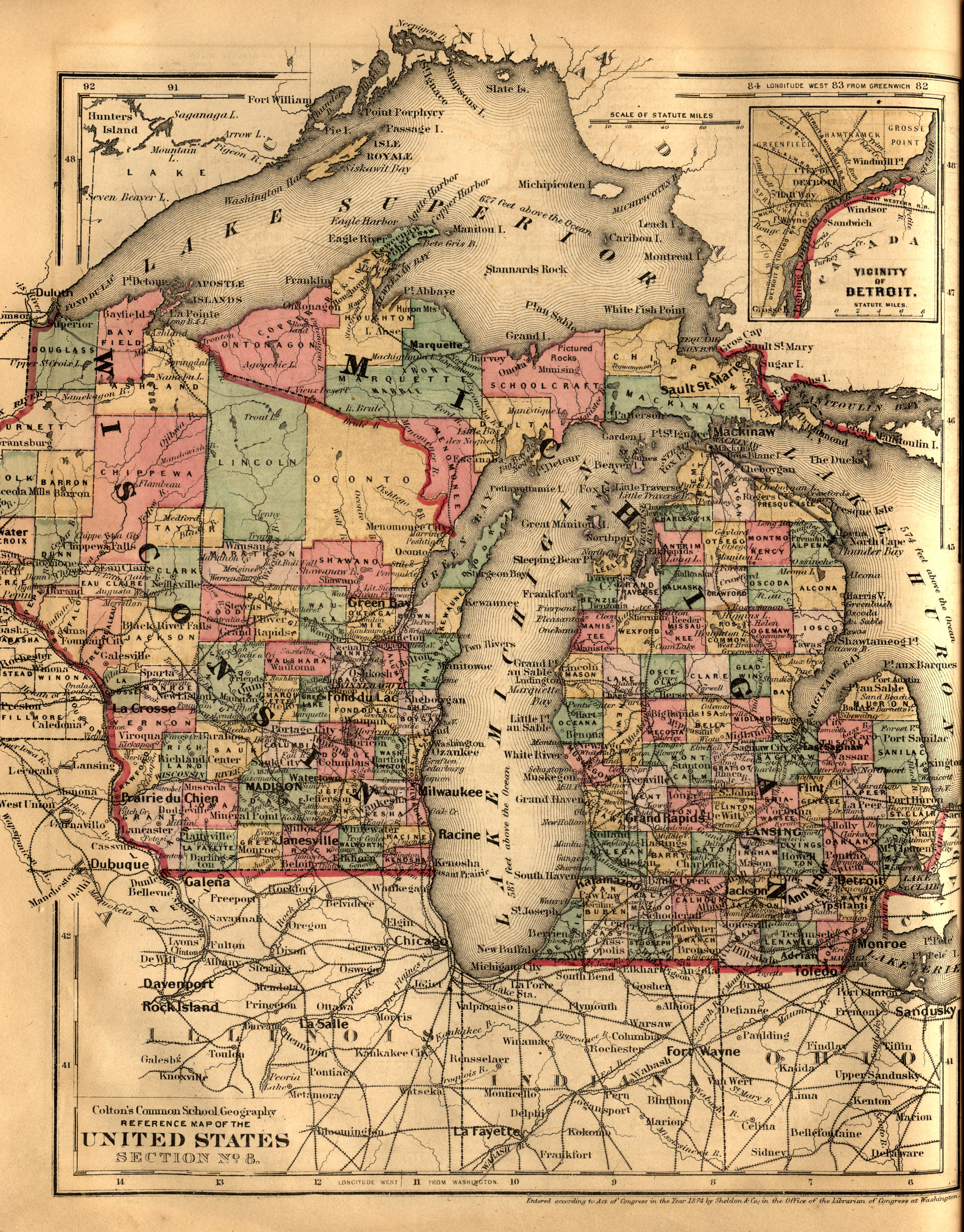
"Reference Map of the United States Section No. 8" (1876) in Colton's common school geography, by J. H. Colton. New York: Sheldon. 1875. [G125.C72 1876]
|
|||
 |
"Map of the States of Michigan and Wisconsin..." in Goode's
school atlas, physical, political and economic, for American schools
and colleges. Chicago, New York, Rand McNally & Co. 1923. [folio G1021 .G6 1923]
|
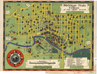 |
"Michigan State College and East Lansing, Michigan"
Designed by James F. Trott. East Lansing, Michigan: Redfern &
Reynolds. 1940. [G4114.E4:2M4 1940 T7]
|
|||
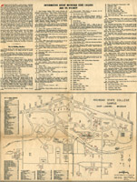 |
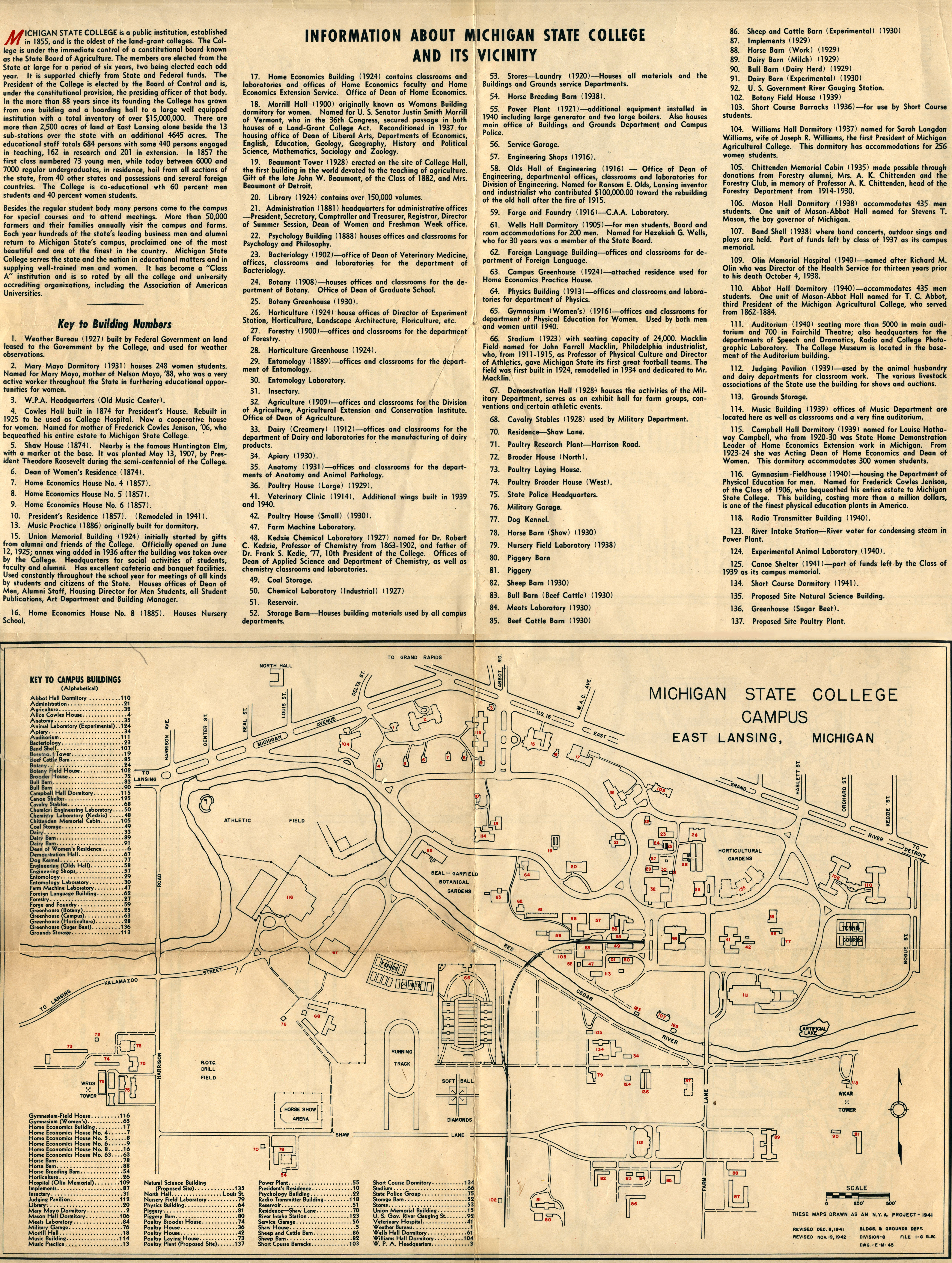
"Michigan State College Campus" (1941) in Maps and Information of Michigan State College and Vicinity. Maps drawn as an N.Y.A. Project (1941) and revised in 1941 and 1942. [843-d A-1942 Michigan]
|
|||
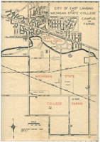 |
"City of East Lansing and Michigan State College Campus and Farms" (1941) in Maps and Information of Michigan State College and Vicinity. Maps drawn as an N.Y.A. Project (1941) and revised in 1941 and 1942. [843-d A-1942 Michigan]
|
|||
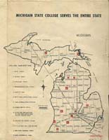 |
"Michigan State College Serves the Entire State" (1941) in Maps and Information of Michigan State College and Vicinity. Maps drawn as an N.Y.A. Project (1941) and revised in 1941 and 1942. [843-d A-1942 Michigan]
|
 |
"Garden Beds" in History of Kalamazoo County,
Michigan, with
illustrations and biographical sketches of its prominent men and
pioneers.
By Samuel W. Durant. Philadelphia, Everets, 1880. [ F572.K2 D9 ] Bed Layout:
Text Pages:
|
Back to
MSU
Online Map Collection HOME
Last updated: June 28, 2005.