 |
"Garden Beds" in History of Kalamazoo
County,
Michigan, with
illustrations and biographical sketches of its prominent men and
pioneers.
By Samuel W. Durant. Philadelphia, Everets, 1880. [
F572.K2 D9 ]
Bed
Layout:
Text Pages:
|
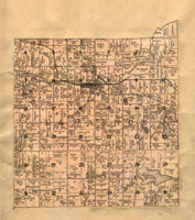
|
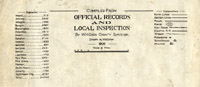
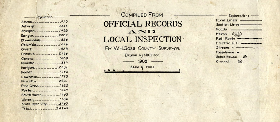
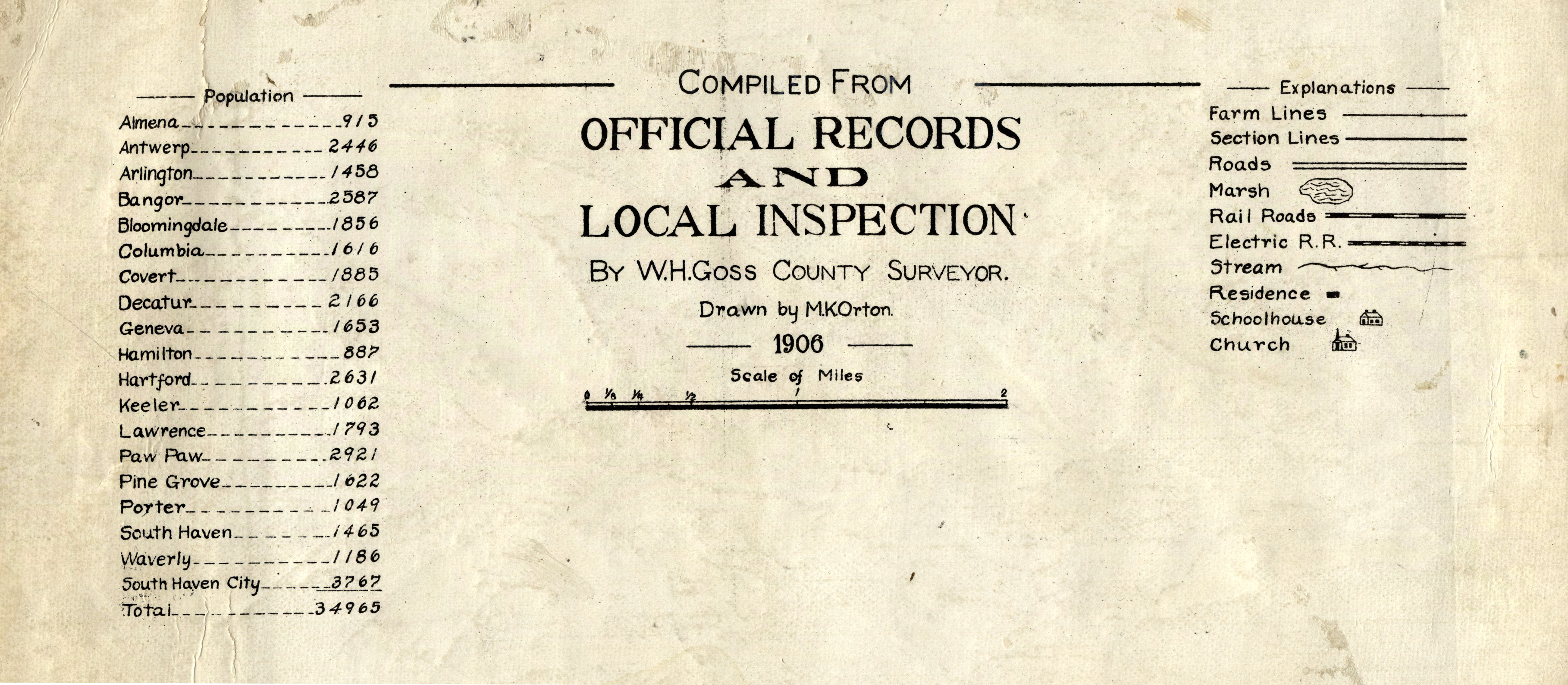
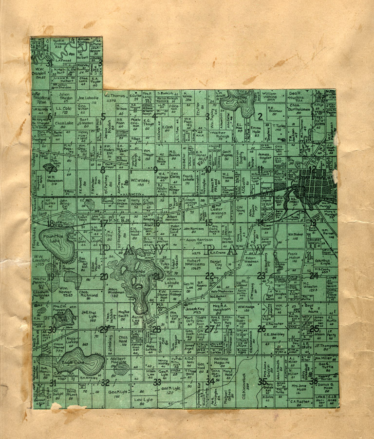
"Compiled from Official Records
and Local Inspection" in Illustrated
Michigan / compiled from
W.H. Goss, County Surveyor. drawn by M.K. Orton, 1906. (pasted inside a 1896 atlas). [G1413.V3
K3 1895]
|
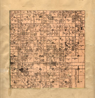
|
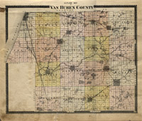
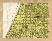
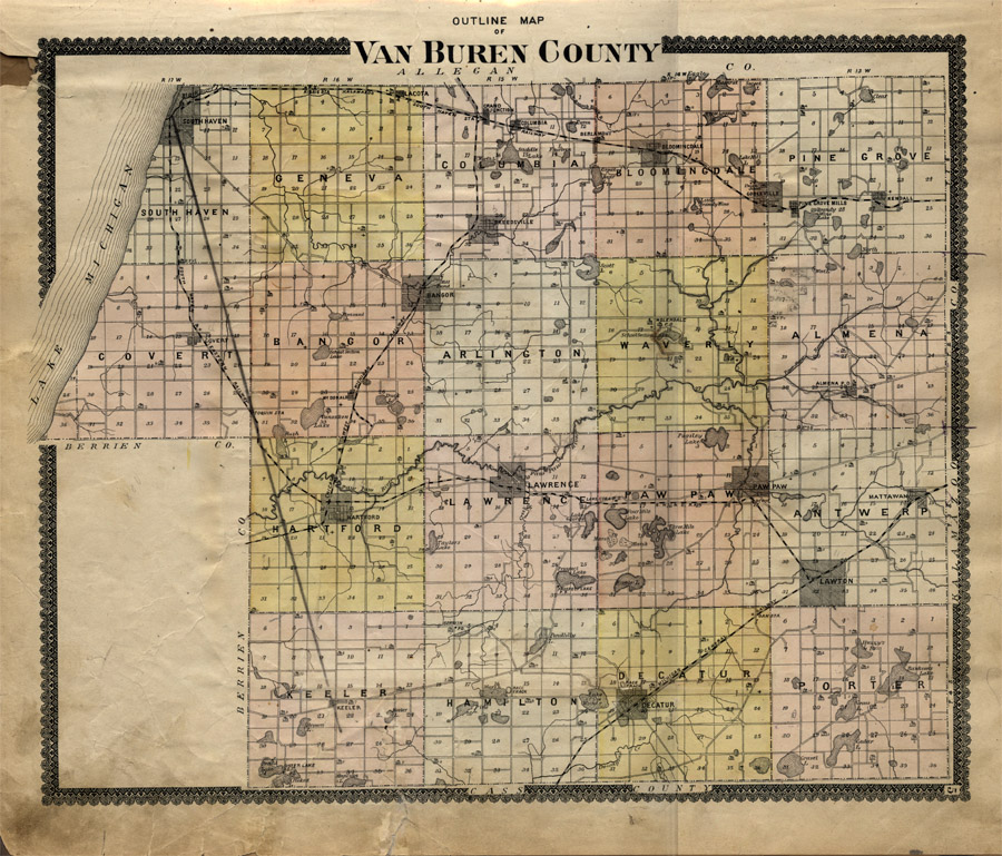
"Outline Map of Van Buren County"
in [Van Buren County, Michigan]
Michigan / compiled from
W.H. Goss, County Surveyor. drawn by M.K. Orton, 1906. (pasted inside a 1896 atlas). [G1413.V3
K3 1895]
|
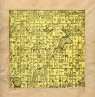
|
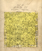
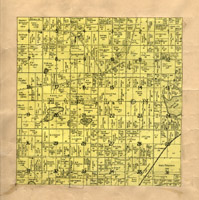
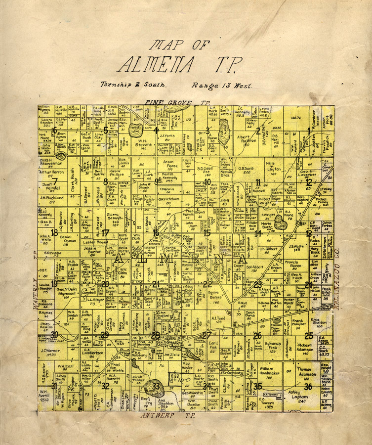
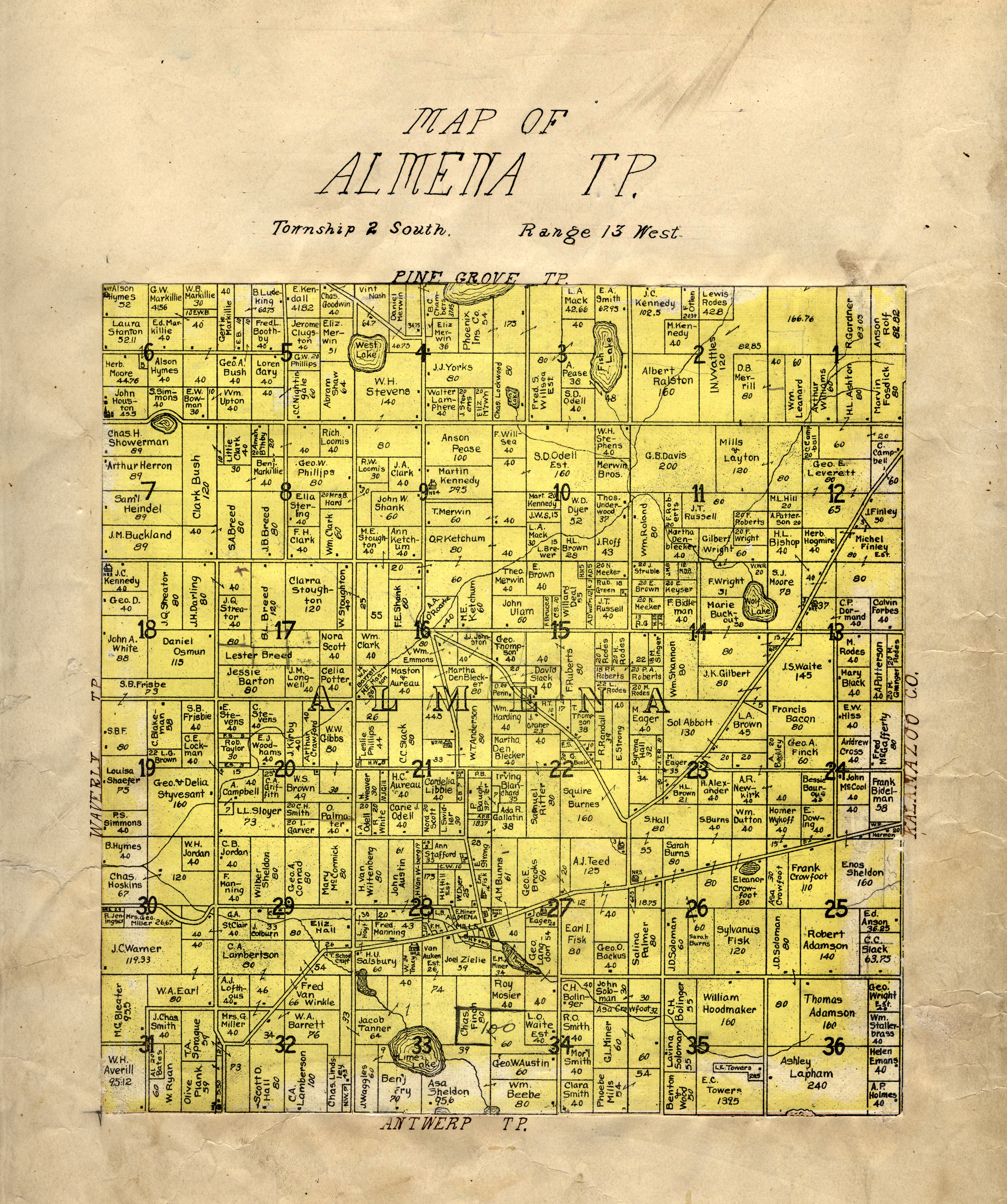
"Map of Almena Township"
in [Van Buren County, Michigan]
Michigan / compiled from
W.H. Goss, County Surveyor. drawn by M.K. Orton, 1906. (pasted inside a 1896 atlas). [G1413.V3
K3 1895]
|
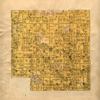
|
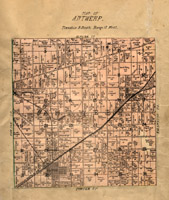
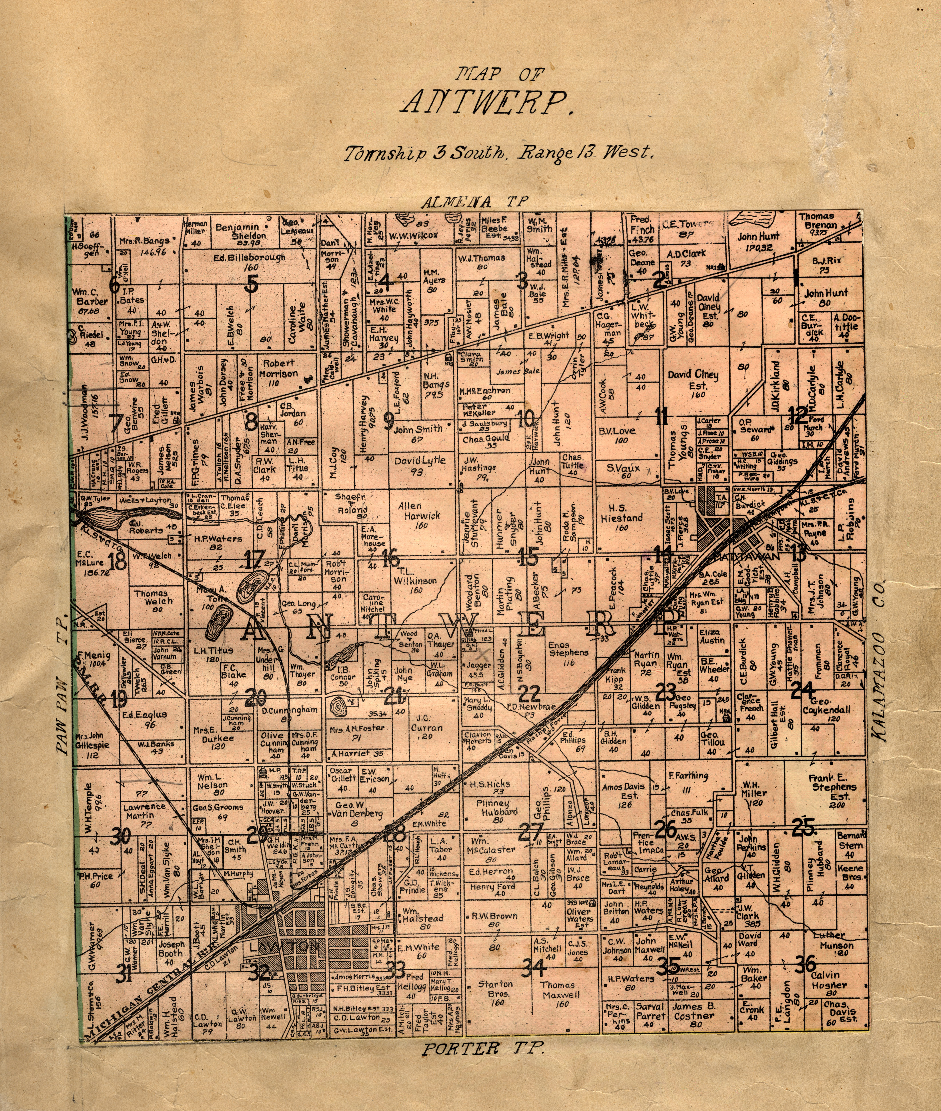
"Map of Antwerp" in Illustrated
Michigan / compiled from
W.H. Goss, County Surveyor. drawn by M.K. Orton, 1906. (pasted inside a 1896 atlas). [G1413.V3
K3 1895]
|
|
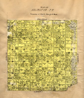
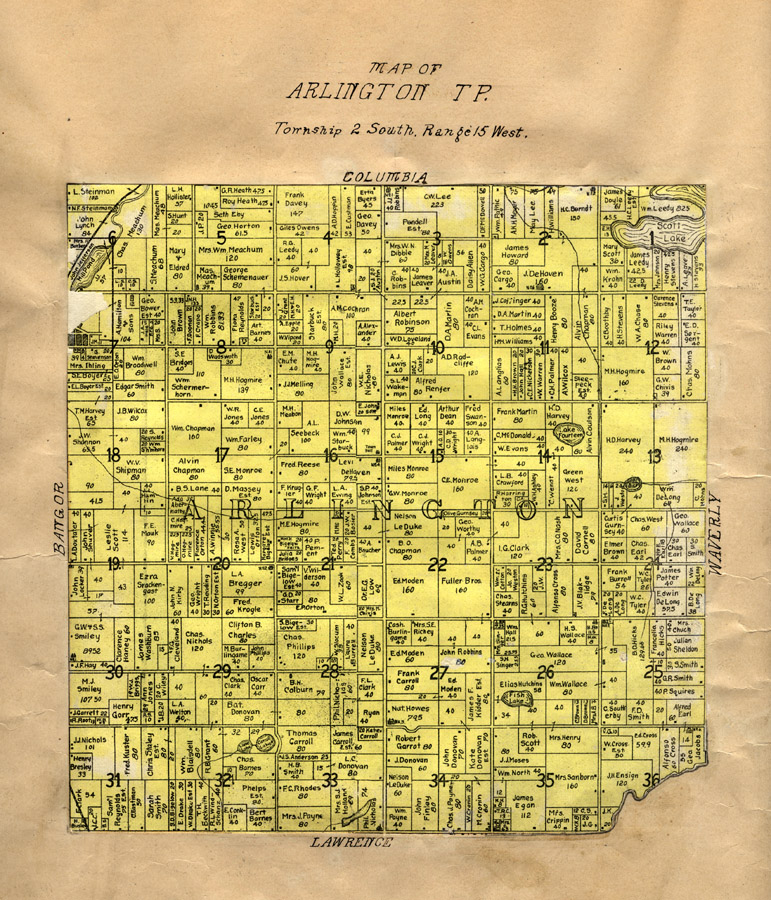
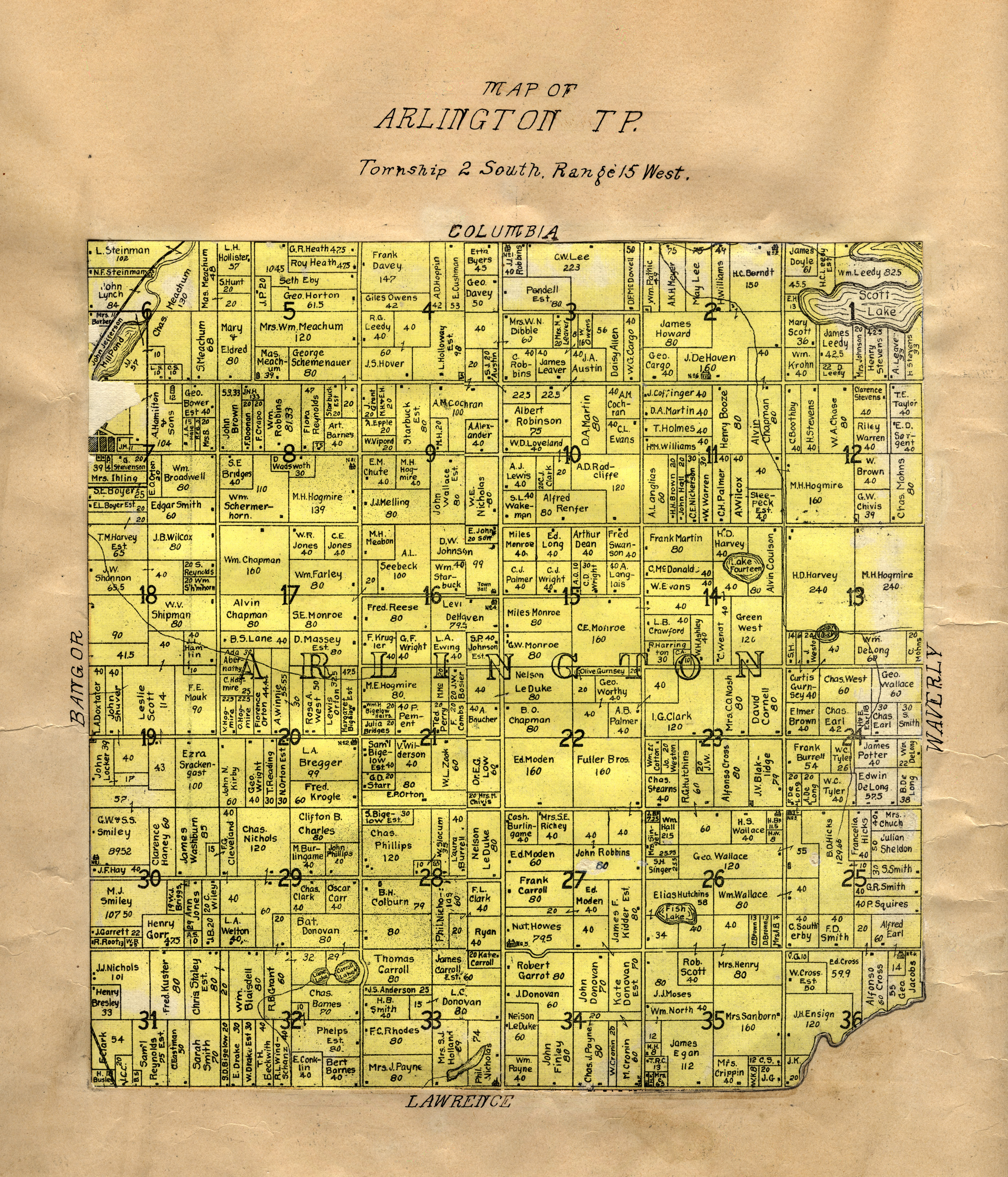
"Map of Arlington Township"
in [Van Buren County, Michigan]
Michigan / compiled from
W.H. Goss, County Surveyor. drawn by M.K. Orton, 1906. (pasted inside a 1896 atlas). [G1413.V3
K3 1895]
|
|
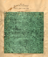
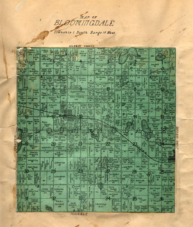
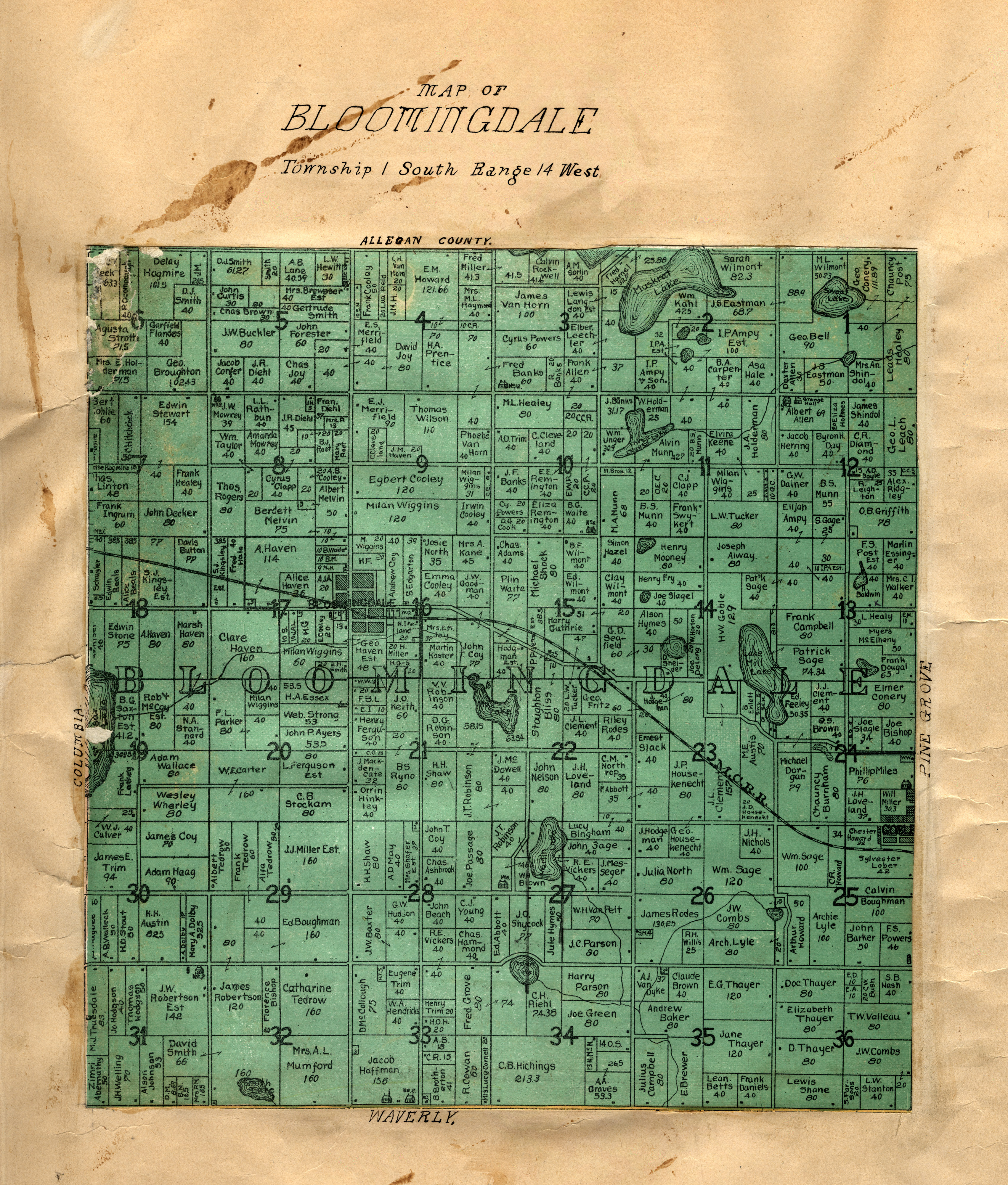
"Map of Bloomingdale" in Illustrated
Michigan / compiled from
W.H. Goss, County Surveyor. drawn by M.K. Orton, 1906. (pasted inside a 1896 atlas). [G1413.V3
K3 1895]
|
|
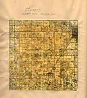
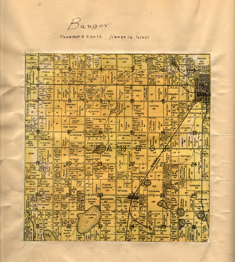
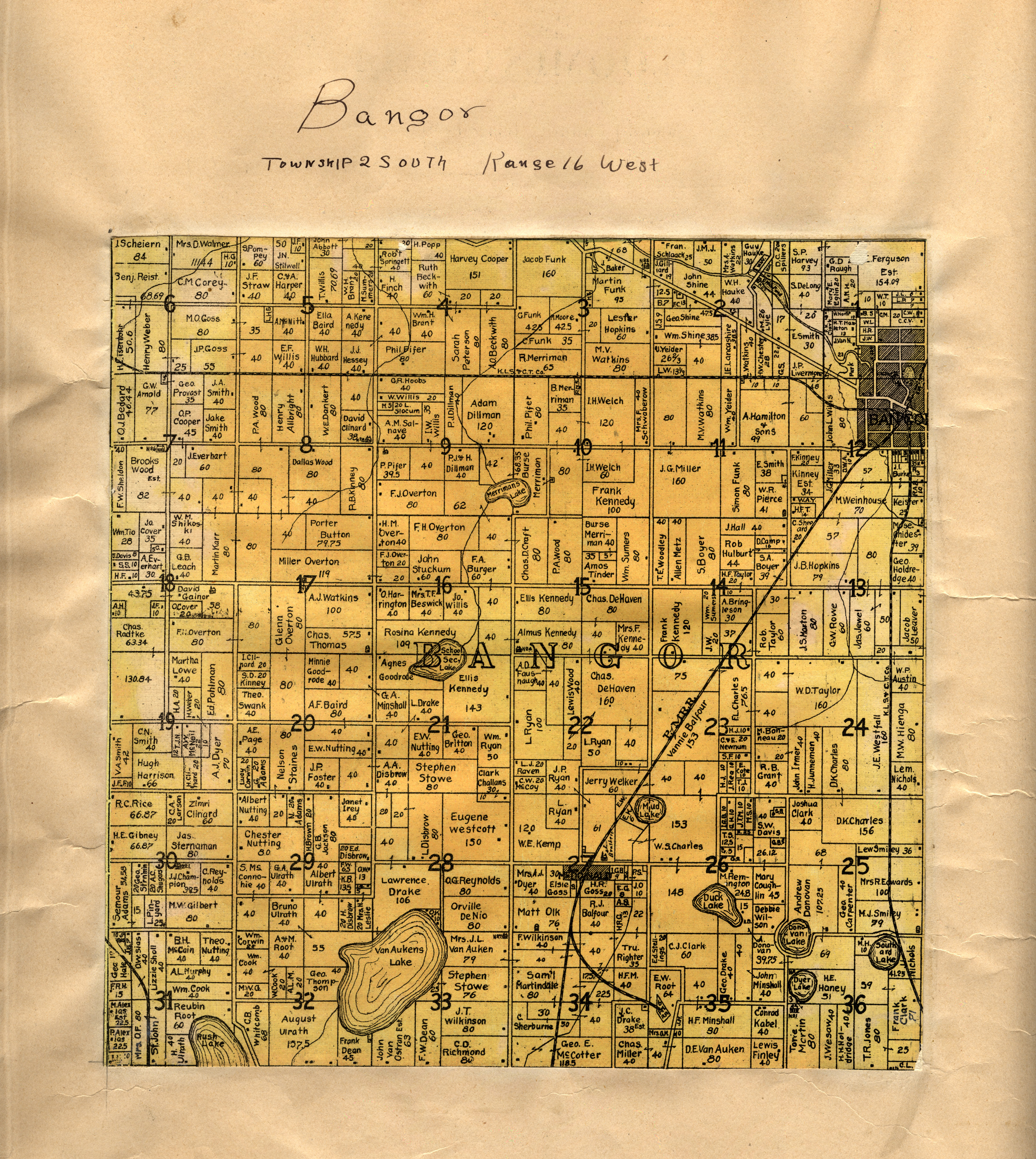
"Bangor" in Illustrated
Michigan / compiled from
W.H. Goss, County Surveyor. drawn by M.K. Orton, 1906. (pasted inside a 1896 atlas). [G1413.V3
K3 1895]
|
|
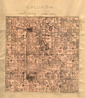
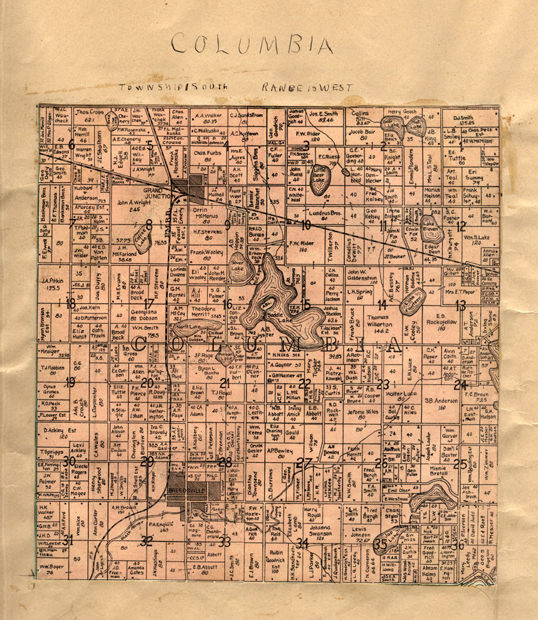
"Columbia" in Illustrated
Michigan / compiled from
W.H. Goss, County Surveyor. drawn by M.K. Orton, 1906. (pasted inside a 1896 atlas). [G1413.V3
K3 1895]
|
|
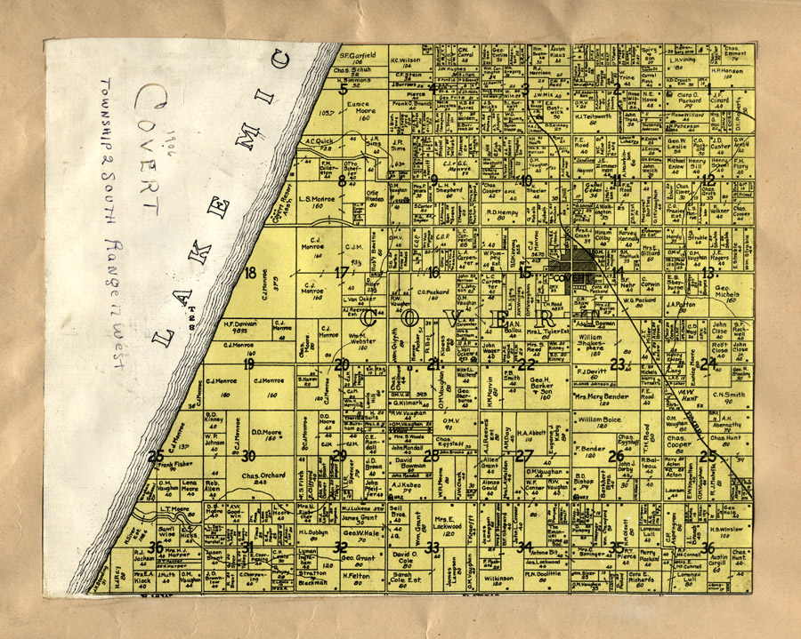
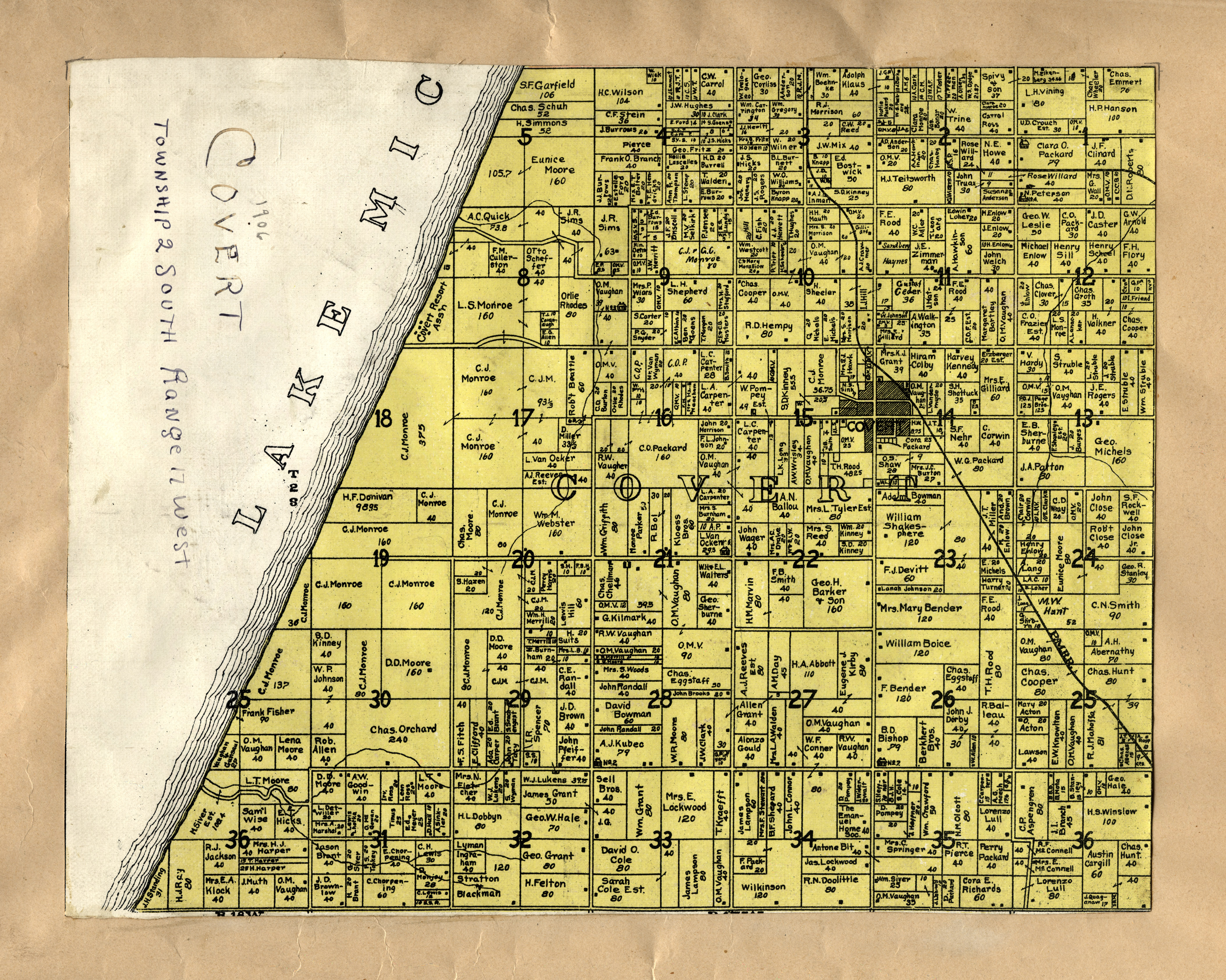
"Covert" in Illustrated
Michigan / compiled from
W.H. Goss, County Surveyor. drawn by M.K. Orton, 1906. (pasted inside a 1896 atlas). [G1413.V3 K3 1895]
|

|
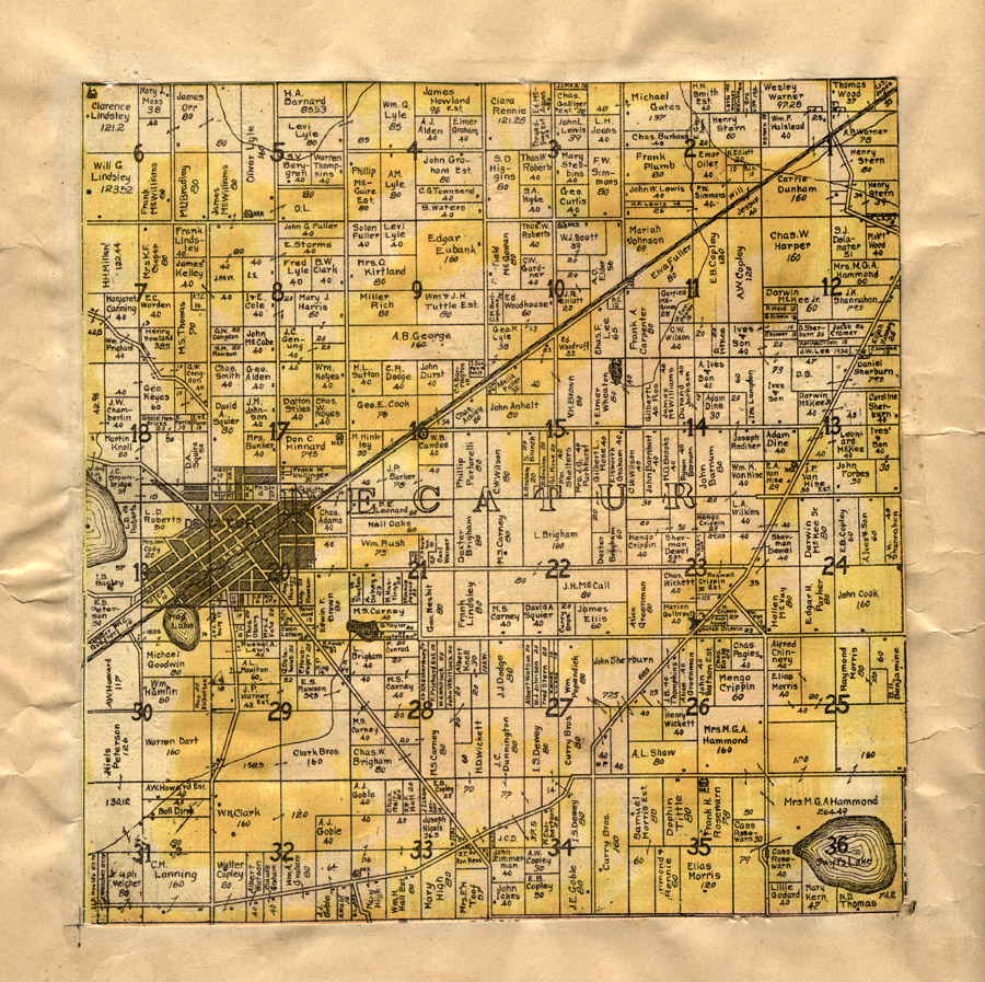
"Decatur" in [Van Buren County, Michigan] / Compiled from Official Records and Local Inspection
W.H. Goss, County Surveyor. drawn by M.K. Orton, 1906. (pasted inside a 1896 atlas). [G1413.V3
K3 1895]
|
|
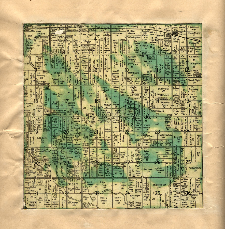
"Geneva" in Illustrated
Michigan / compiled from
W.H. Goss, County Surveyor. drawn by M.K. Orton, 1906. (pasted inside a 1896 atlas). [G1413.V3
K3 1895]
|
|
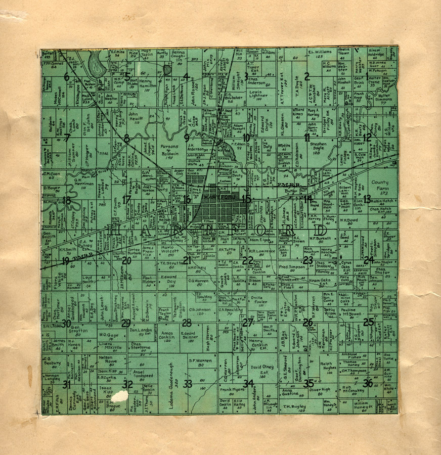
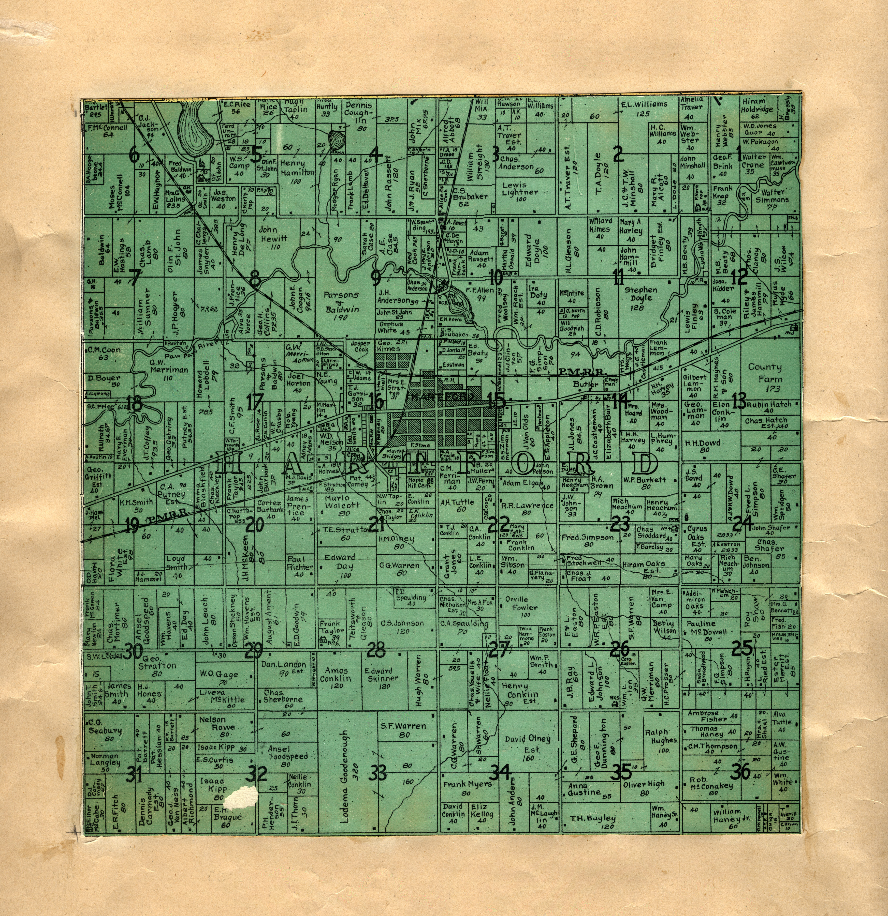
"Hartford" in Illustrated
Michigan / compiled from
W.H. Goss, County Surveyor. drawn by M.K. Orton, 1906. (pasted inside a 1896 atlas). [G1413.V3
K3 1895]
|
|
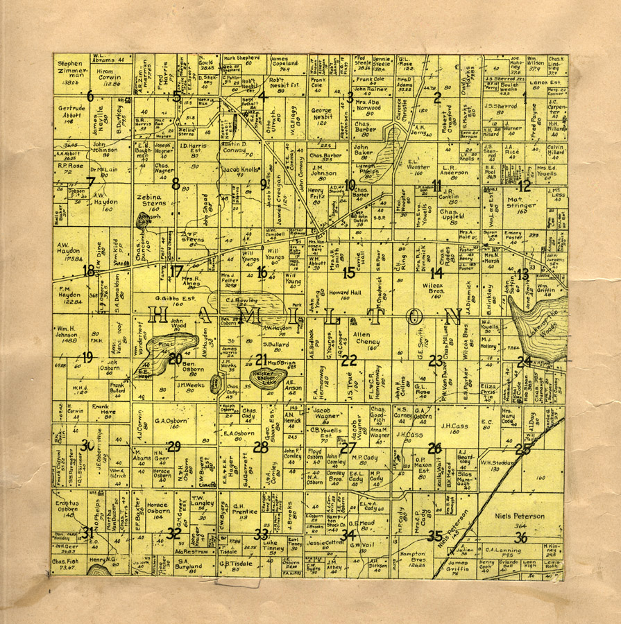
"Hamilton" in Illustrated
Michigan / compiled from
W.H. Goss, County Surveyor. drawn by M.K. Orton, 1906. (pasted inside a 1896 atlas). [G1413.V3
K3 1895]
|

|
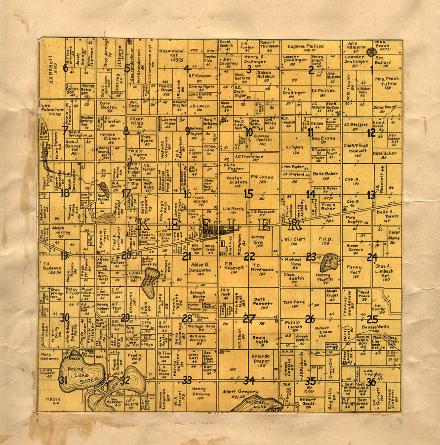
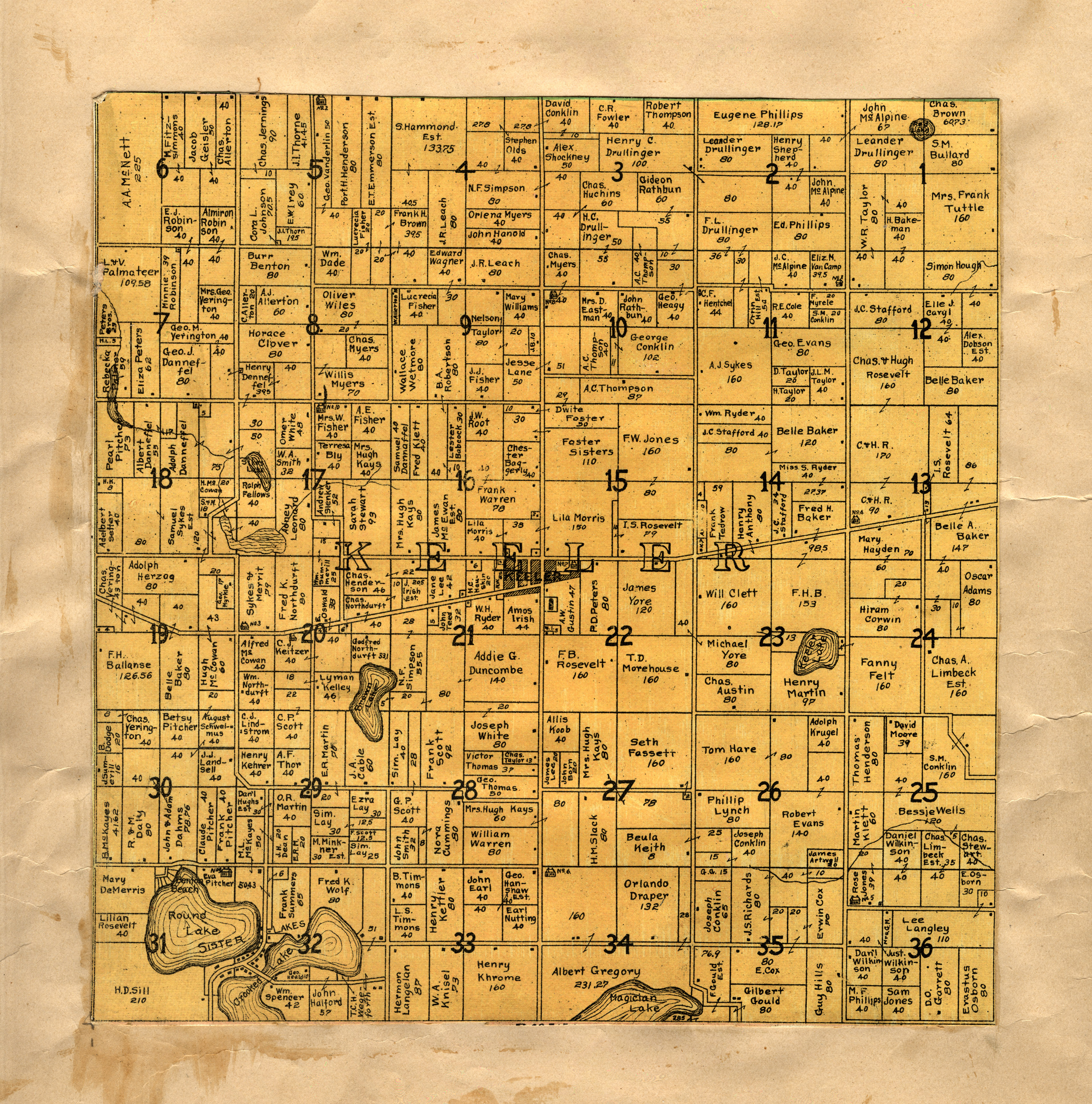
"Keeler" in Illustrated
Michigan / compiled from
W.H. Goss, County Surveyor. drawn by M.K. Orton, 1906. (pasted inside a 1896 atlas). [G1413.V3
K3 1895]
|
|
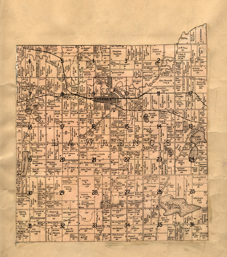
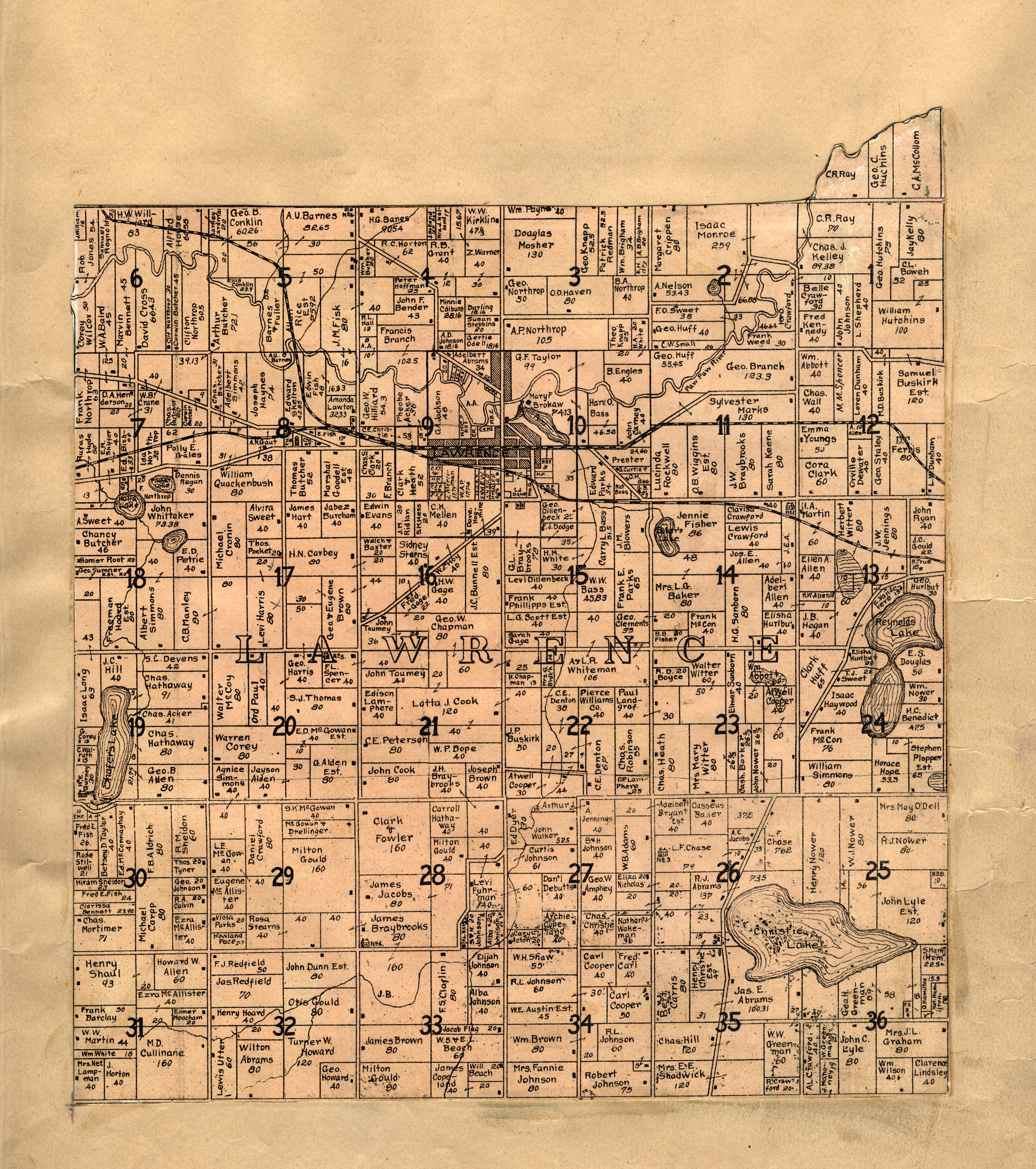
"Lawrence" in Illustrated
Michigan / compiled from
W.H. Goss, County Surveyor. drawn by M.K. Orton, 1906. (pasted inside a 1896 atlas). [G1413.V3
K3 1895]
|

|
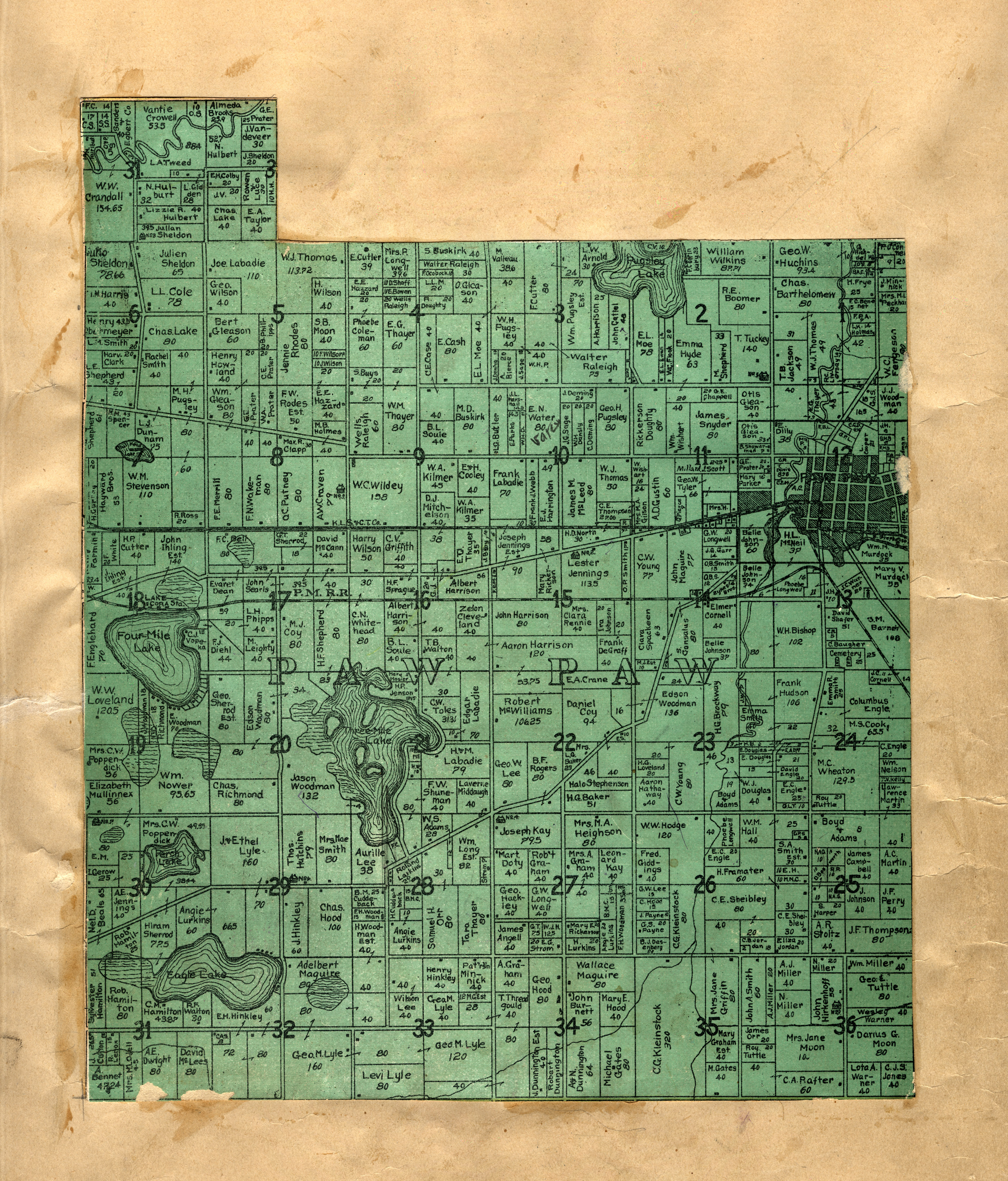
"Paw Paw" in Illustrated
Michigan / compiled from
W.H. Goss, County Surveyor. drawn by M.K. Orton, 1906. (pasted inside a 1896 atlas). [G1413.V3
K3 1895]
|
|
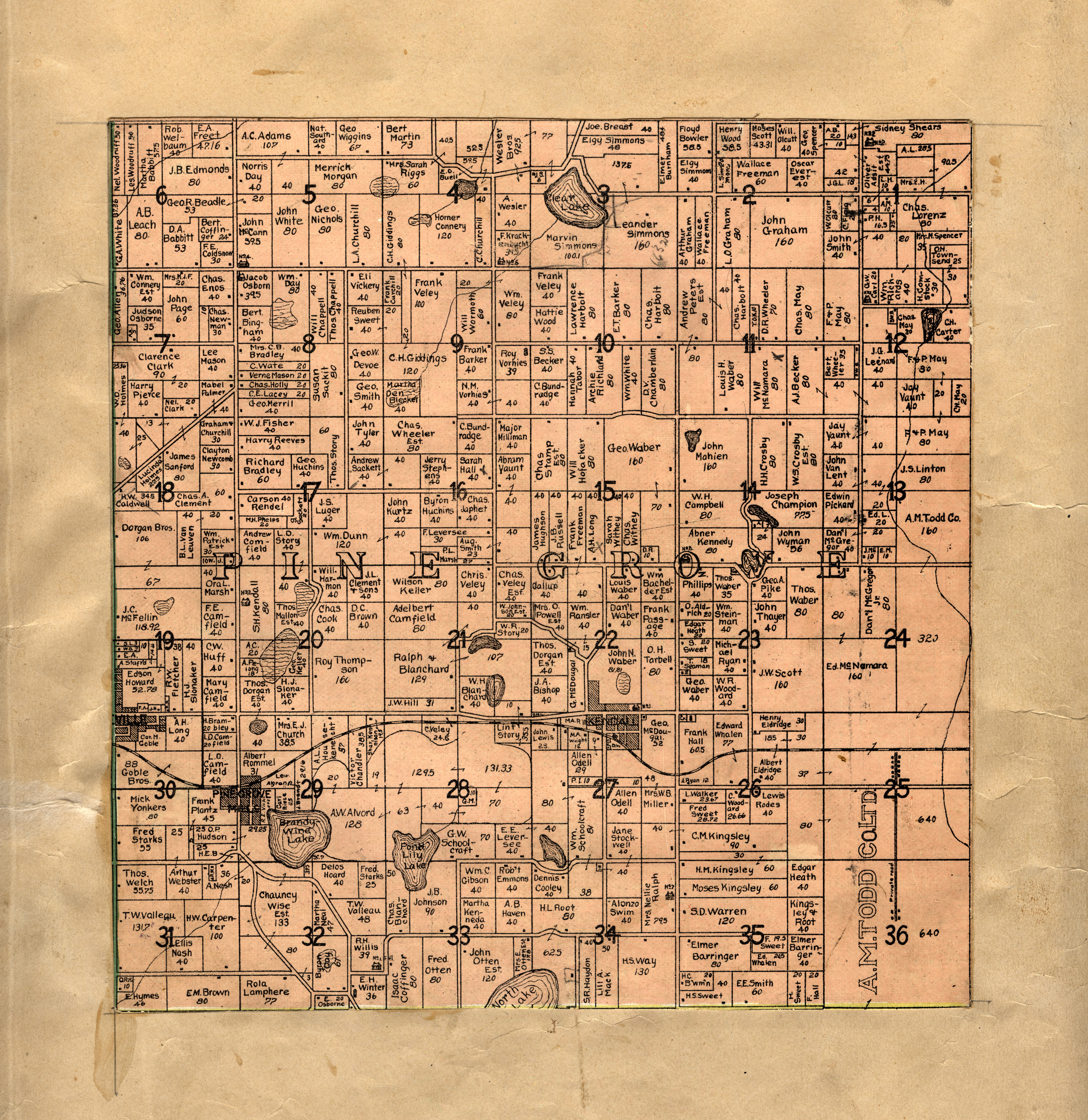
"Pine Grove" in Illustrated
Michigan / compiled from
W.H. Goss, County Surveyor. drawn by M.K. Orton, 1906. (pasted inside a 1896 atlas). [G1413.V3
K3 1895]
|
|
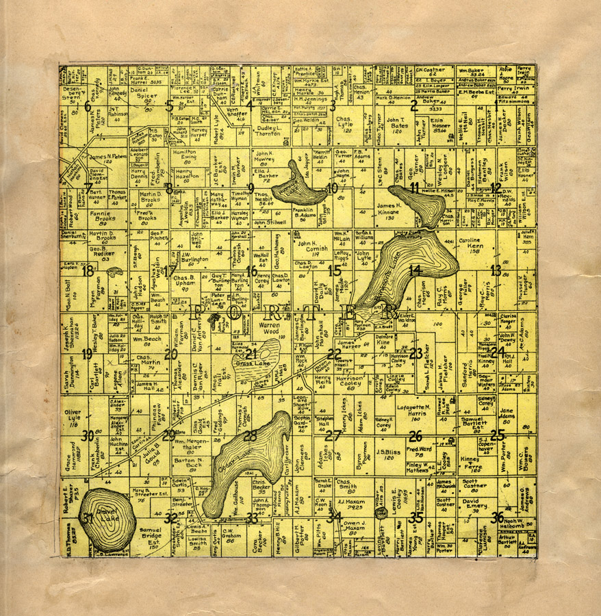
"Porter" in Illustrated
Michigan / compiled from
W.H. Goss, County Surveyor. drawn by M.K. Orton, 1906. (pasted inside a 1896 atlas). [G1413.V3
K3 1895]
|

|
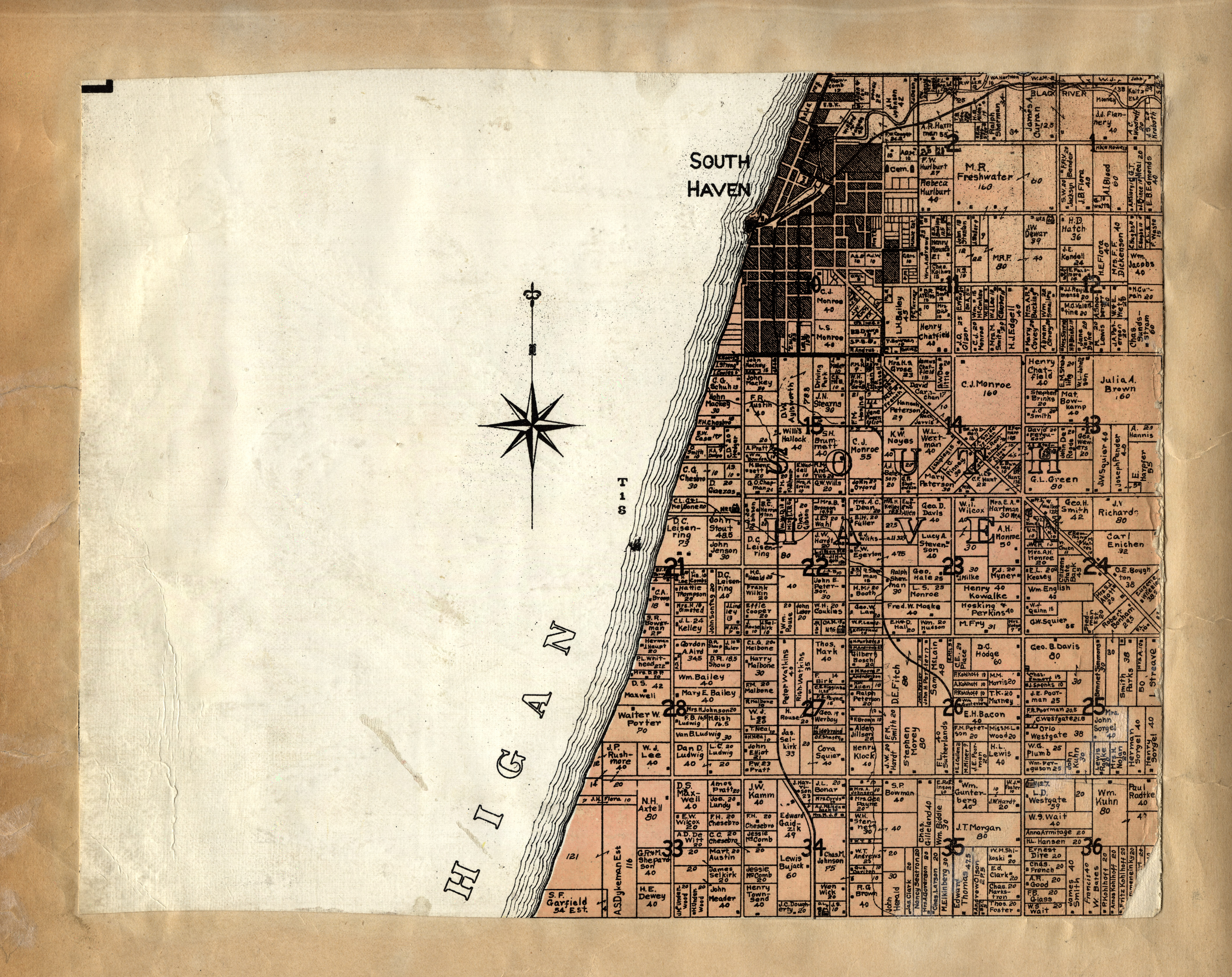
"South Haven" in Illustrated
Michigan / compiled from
W.H. Goss, County Surveyor. drawn by M.K. Orton, 1906. (pasted inside a 1896 atlas). [G1413.V3
K3 1895]
|
|
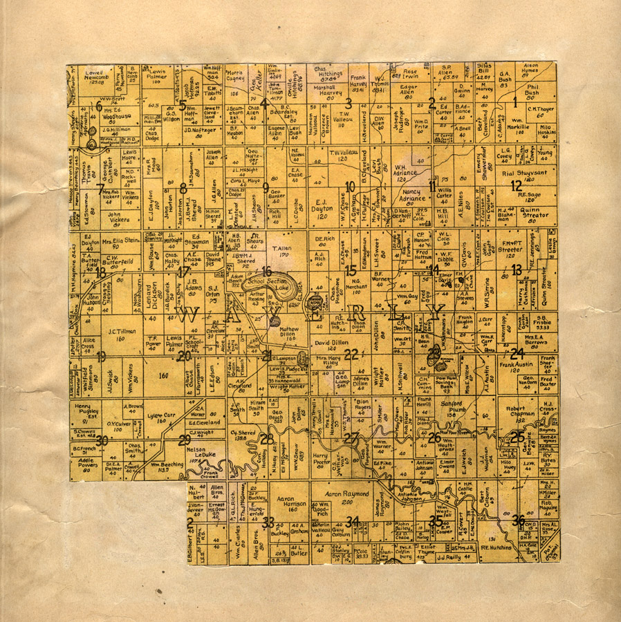
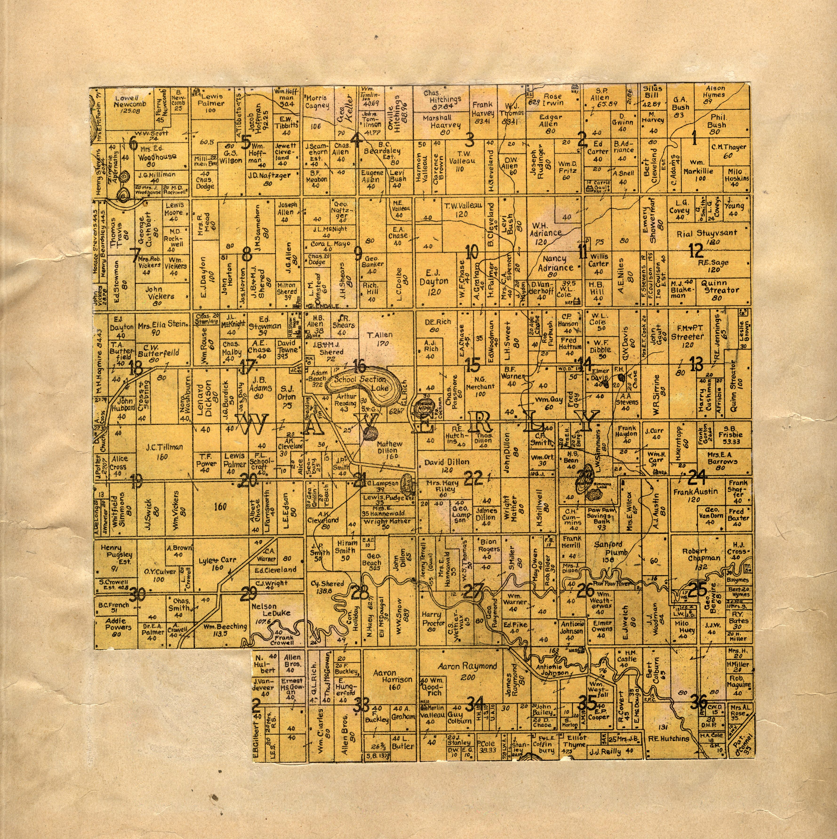
"Waverly" in Illustrated
Michigan / compiled from
W.H. Goss, County Surveyor. drawn by M.K. Orton, 1906. [G1413.V3
K3 1895]
|


